
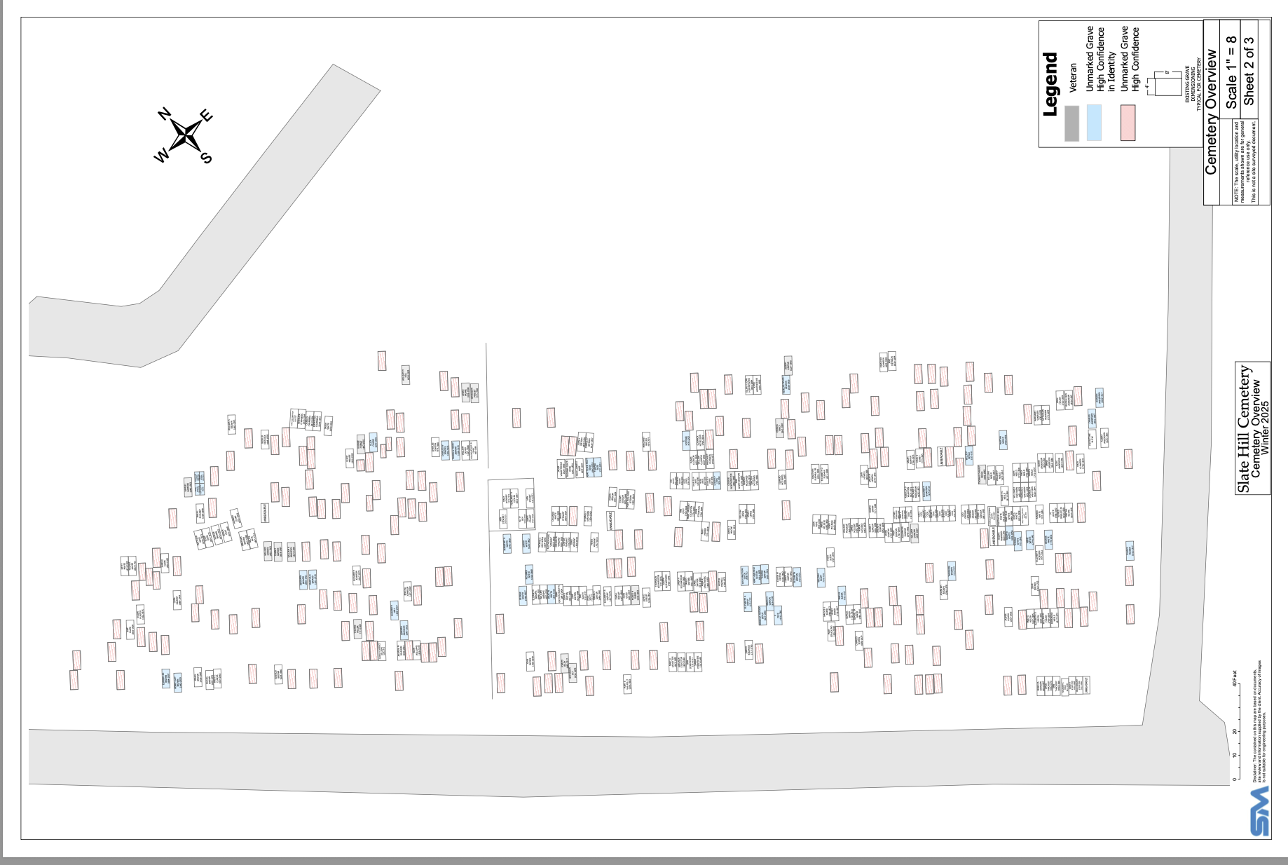
Maps
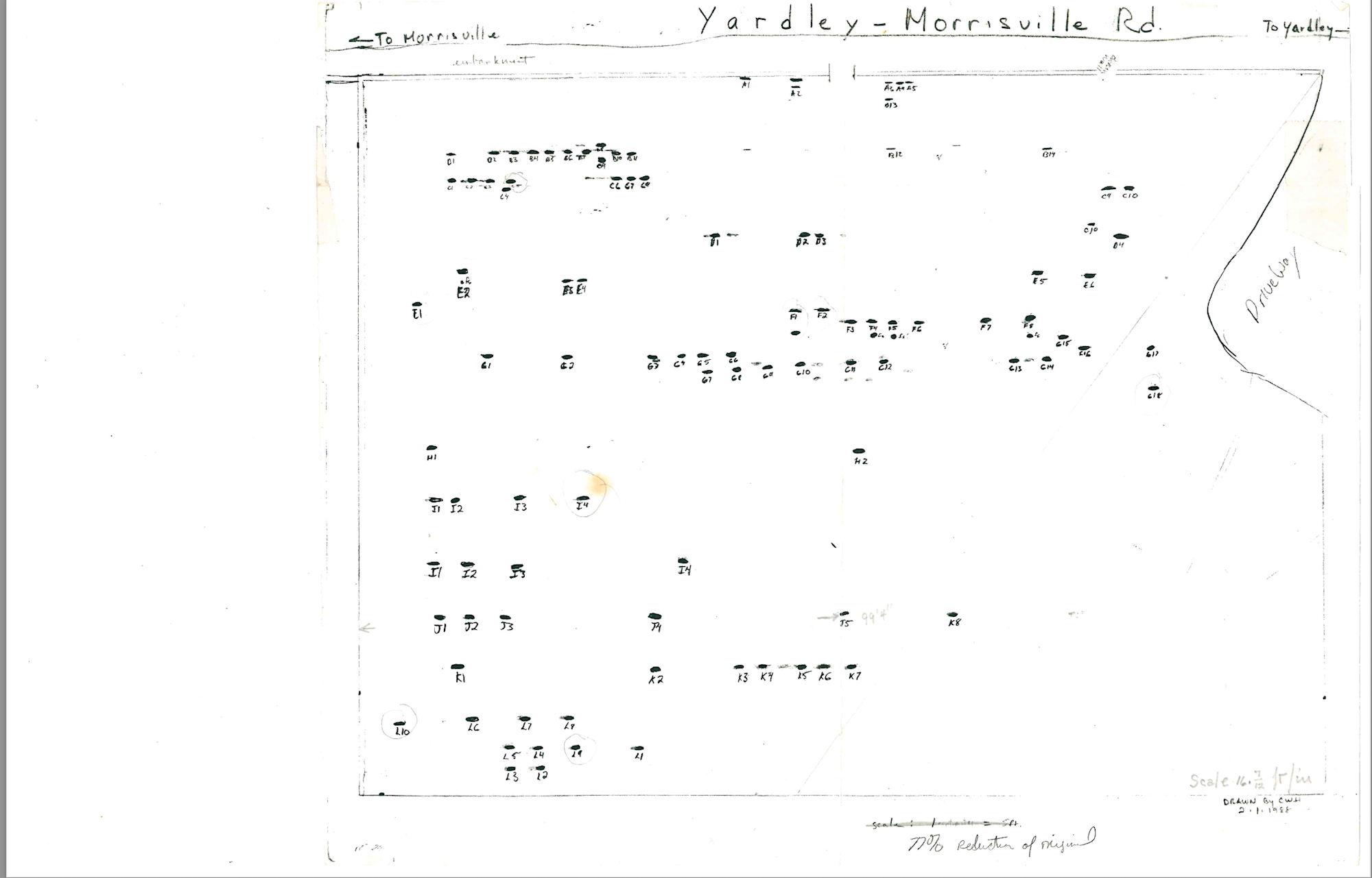
Here are several maps of Slate HIll Cemetery. The 1926 map is the earliest map we have of the cemetery and it is only of the Friends Side. We have a 1991 map of the Segregated Side done by Christopher Heinz as his Eagle Scout Project.
In 2024 we contracted with Sentry mapping for a ground penetratting radar map and those are the additional maps.
To see the live web map version click here. You can search by name.
Under each map picture is a pdf you can download. If printing we recommend printing on blueprint paper for best results.
GPNR 2024 Plot Names
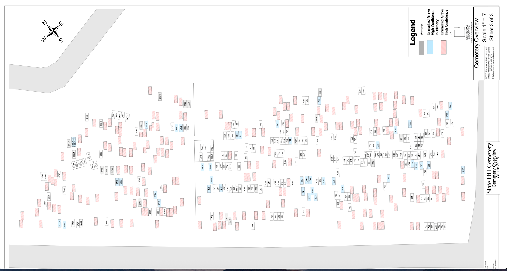
GPNR 2024 Plot Numbers
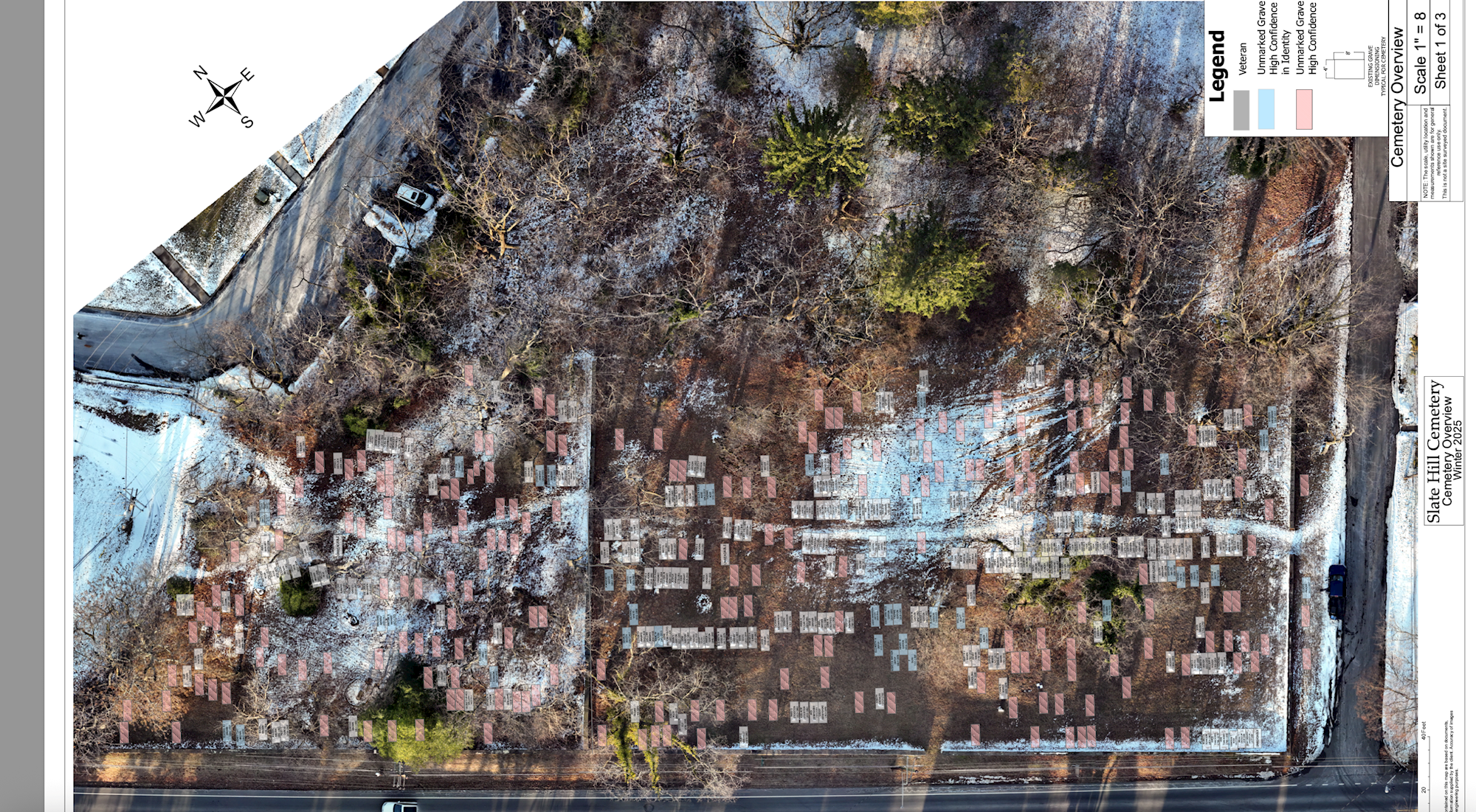
GPNR Drone Photo
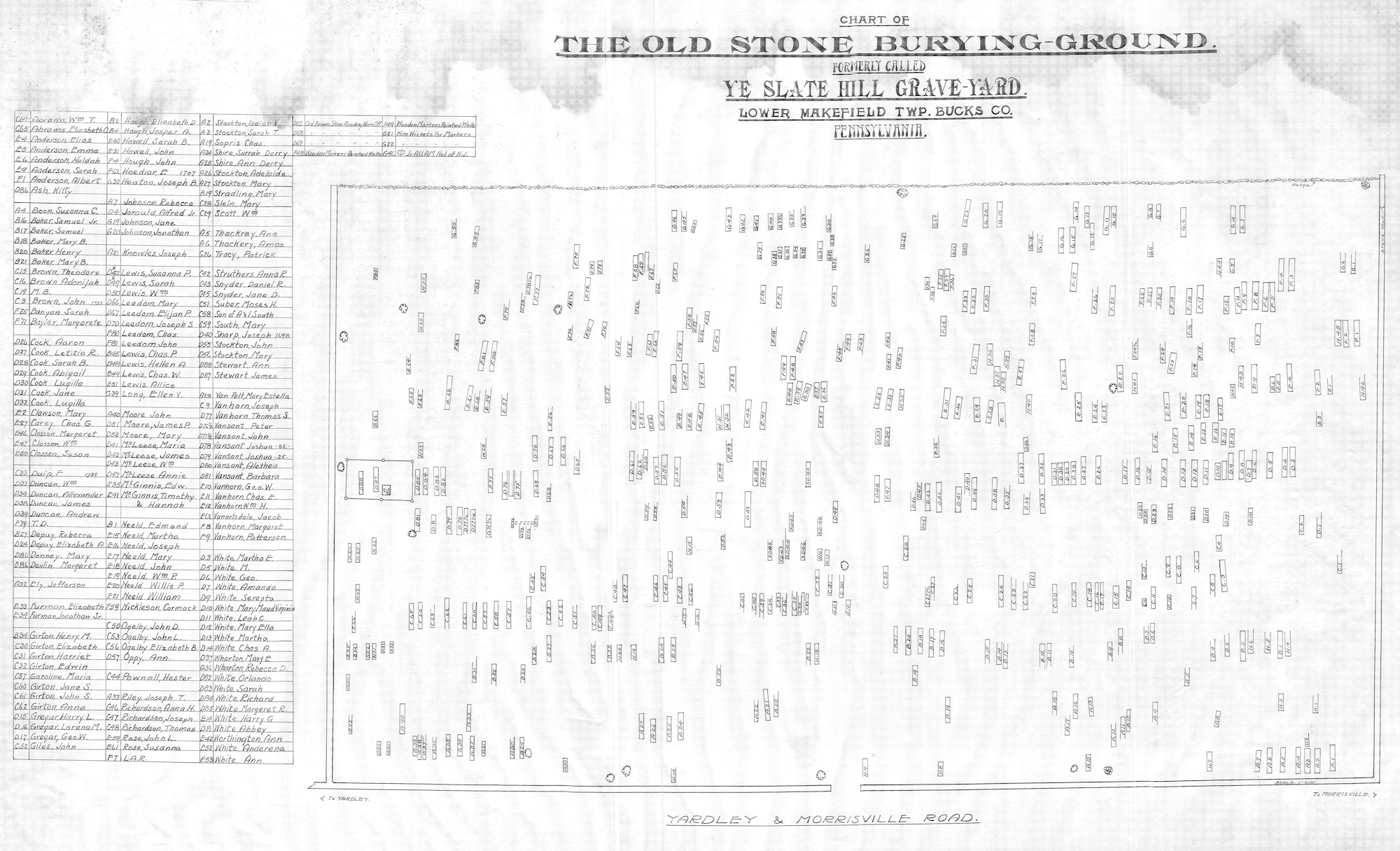
1926 Map
1991 Segregated side map-Credit Christopher Heinz